You Are Here: Online Campus Map Offers New Features, Virtual Tours
Campus Life

Published September 17, 2015
Finding your way around the Smith campus just got easier—and a lot more fun.
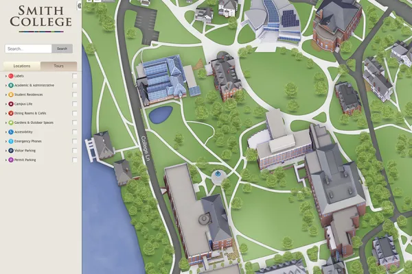
A new interactive map gives visitors, students, staff and faculty an easier way to locate buildings, parking, outdoor spaces, athletic facilities, dining rooms and emergency phones on campus.
Designed by CampusBird, and launched last week, the new online map lets users scroll to various areas of the campus, zoom in and out, and get detailed information in a single click. The new map features a simple user interface that provides easy viewing on mobile phones, tablets or desktop computers. The map also features a print option that lets users create printed maps for events.
Customized tours, such as a virtual walking tour and a tour of outdoor art at Smith—along with lifelike renditions of buildings and interior and exterior photos—help give map users a more tangible sense of place on campus. The 3D color illustrations not only depict streets and buildings, but also Smith’s beautiful natural setting, including walking paths and trees.
The map also allows users to explore the campus in the context of the larger Northampton community. The campus map overlays a Google map showing city streets, businesses, parks—and more.
CampusBird has created maps for two other Five College institutions—Hampshire College and Amherst College—and for more than 100 other higher educational institutions across the country.
The College Relations team at Smith will continue to update and enhance Smith’s new map with additional tours, photos, videos and panoramic views.
We welcome your feedback. Please share your ideas for additional tours, photographs or other map features, as well as your comments, by emailing newsite@smith.edu.