Fun With Drones: Students Learn Basics of Remote-Controlled Flight
Campus Life

Published January 27, 2017
As a result of a “Fun With Drones” class she took during this year’s Interterm, first-year Smithie Emily Wert quips that she is considering changing her Facebook page.
“A drone is going to be my profile photo,” Wert said with a smile at a final class session in Smith’s Spatial Analysis Lab. “This is who I am now!”

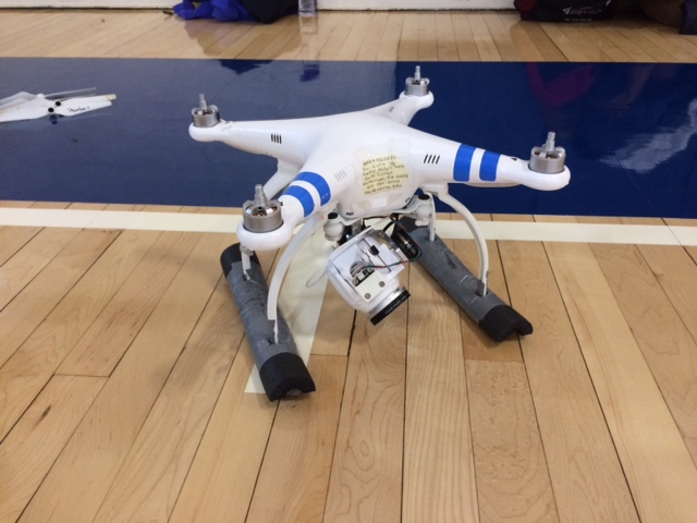
This Phantom 3 model drone was used by students in the “Fun With Drones” Interterm course.
Generating such enthusiasm was the main goal of the Interterm course taught by Jon Caris, director of the Spatial Analysis Lab (SAL), engineering major Alex Widstrand ’17 and SAL post-baccalaureate fellow Scott Gilman.
Over the course of five days in January, students explored the basics of drone technology, mapping flight missions for the small aerial devices and safety regulations governing remote-controlled drone flights.
From the very first class, students also got hands-on flying experience with two different drones, first on a simulator, then in practice sessions at Scott Gym and MacLeish Field Station.
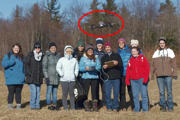
MacLeish turned out to be the more challenging site for flying, due to cold and windy conditions. The practice score for that day: Trees 1; Student Drone Pilots 0.
Wert, who plans to study neuroscience at Smith, said she enrolled in “Fun With Drones” hoping that flying would be the main focus.
“I actually didn’t realize there would be mapping involved,” she said. “I’m glad I signed up. The class turned out to be a lot more interesting than I’d expected.”
Geosciences major Lizzie Sturtevant ’18 had used photogrammetric data from drones during a summer research project about Paradise Pond, but had not had many opportunities to actually operate a drone.
Signing up for the Interterm class was “a logical next step,” Sturtevant said. “From here, I could choose to go on and get certified as a pilot.”
Caris said the Interterm course was designed to draw students from a range of disciplines and to inspire ideas for using drones in the arts as well as the sciences.
The course also incorporated design thinking principles developed last spring by Widstrand ’17 and her classmates in a Design Thinking Studio course. Students in the studio course created a Drone Thinking Initiative website as a way to spark dialogue on campus about potential applications of drone technology. (The site, which developed into the Interterm course website, also features information about safety rules for operating drones and a blog about “Fun With Drones.”)
Widstrand said she was impressed by how quickly students in the Interterm course learned basic techniques for mapping and directing drone flights.
“We started with a group that was initially a bit nervous to fly, but we ended the week noticeably more confident in our maneuvers and with evident knowledge of how to safely operate the drones,” she said.
Beginners’ jitters were evident during an early practice session in Scott Gym when only one or two students initially stepped forward to try flying drones in the confines of the softball practice net.
Sturtevant was one of them. As her classmates looked on, she reviewed a safety checklist, then digitally powered up a Phantom 3 drone and directed it to hover about four feet in the air. (Military drones can fly at very high altitudes, but smaller civilian versions are legally limited to flying 400 feet above ground level in outdoor environments).
Caris was encouraging—even when the Phantom ended up in the net instead of on the landing pad. “That was actually a perfect landing,” he said to Sturtevant. “You didn’t crash it.”
When Caris asked for another volunteer pilot, numerous hands rose into the air.
Cindy Li ’18 said the hardest maneuver was the “come back home” option, which required a clear sense of the orientation of the airborne drone.
“When it’s bright outside and there is glare, it’s hard to tell which is the front of the drone,” she explained. “I was thinking that adding some bright contrasting tape to the front would help, so it’s not just a white drone against a white background of clouds.”
In addition to flying lessons, Li said she enjoyed class discussions of regulatory issues related to drones.
“So many people are using them now,” noted Li, who is majoring in engineering. “But in all of the YouTube videos filmed from drones, people don’t seem to be abiding by FAA regulations.”
Students will have a chance to apply the knowledge they gained in the Interterm class during a March field trip to St. Catherines Island, Ga., where participants will help the Kashmir World Foundation use drones to map sea turtle nesting sites and tortoise burrows.
Widstrand said five of the 11 students who enrolled in “Fun With Drones” have expressed interest in the field trip, adding, “I think they will find this practical application of their new skills to be especially rewarding.”
Caris said students in the Interterm course shared ideas for future learning opportunities on campus, including a drone racing club and more courses and research projects using drones.
Li, who will be spending this semester in China, knows exactly how she wants to pursue her newfound interest in drones.
“I just want to fly more,” she said.
Students in the "Fun With Drones" Interterm class flying a drone at MacLeish Field Station. Instructor Jon Caris, director of Smith's Spatial Analysis Lab, is third from right.